Loading content...
Explore All Posts
Explore DC Metros in one place
Lines
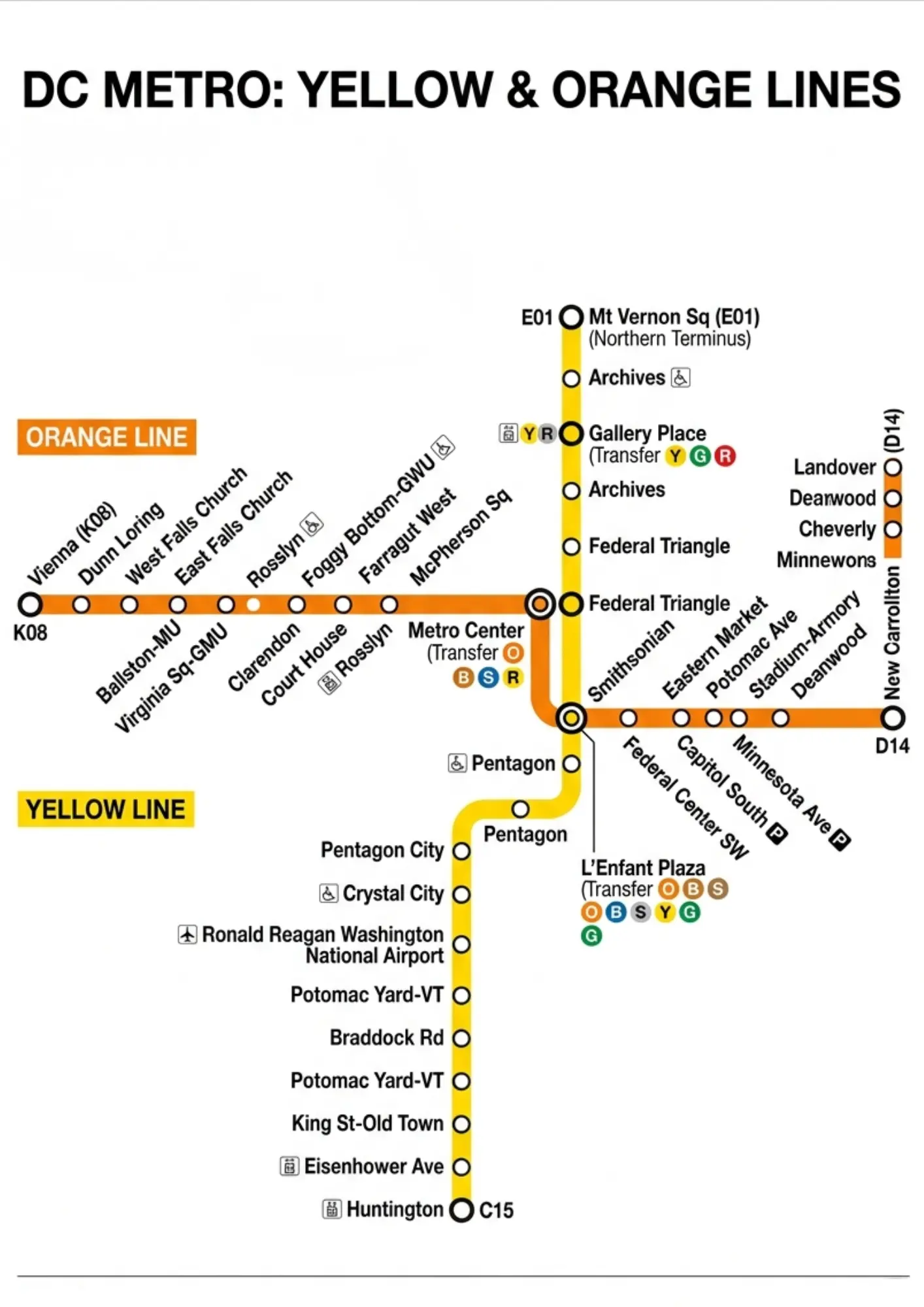
DC Metro Yellow & Orange Lines: Routes & Differences Guide
The Washington Metro Yellow Line connects Huntington to Greenbelt, serving key stops like L’Enfant Plaza and Reagan Airport. The Washington Metro Orange Line runs from Vienna to New Carrollton, linking suburbs to downtown Washington, D.C.
M
Mindy Schapiro14 Apr 2026
Lines
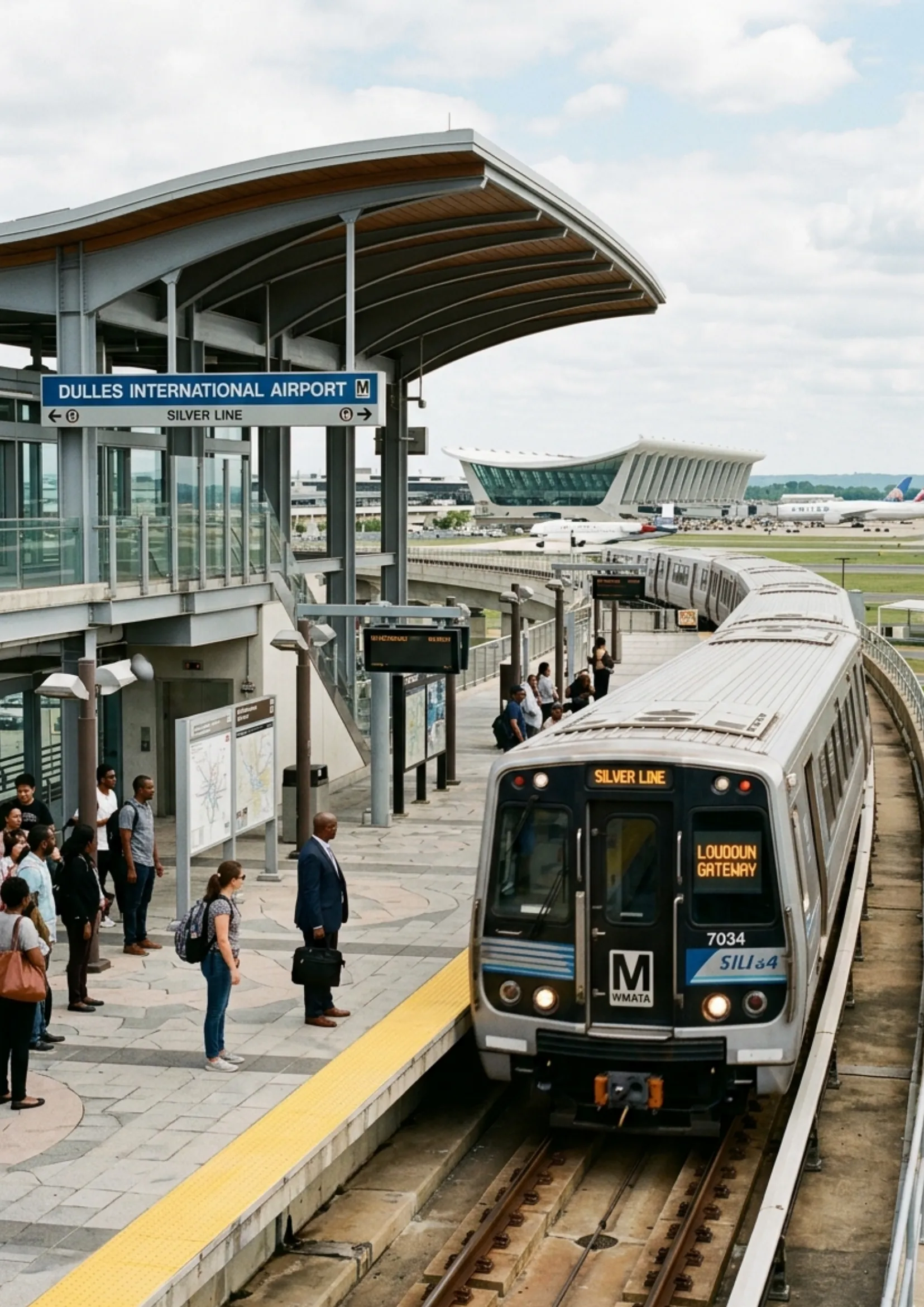
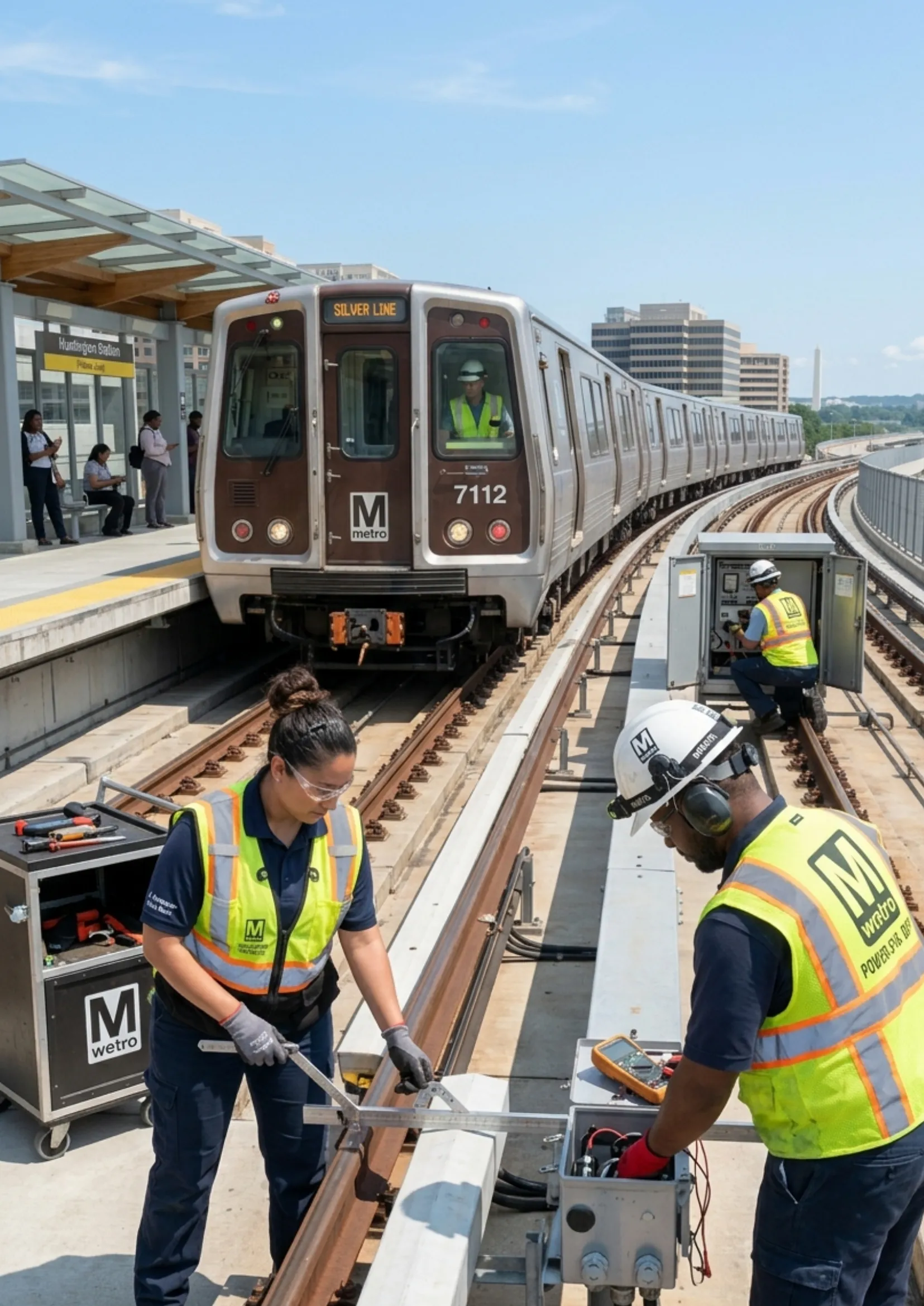
DC Metro Silver Line: Dulles Airport, Tysons Corner
The DC Metro Silver Line runs from Ashburn, Virginia to Largo Town Center, connecting Dulles Airport, Tysons, and downtown Washington, D.C. It provides a key link between suburbs, business hubs, and major transit corridors.
M
Mindy Schapiro14 Apr 2026
Lines
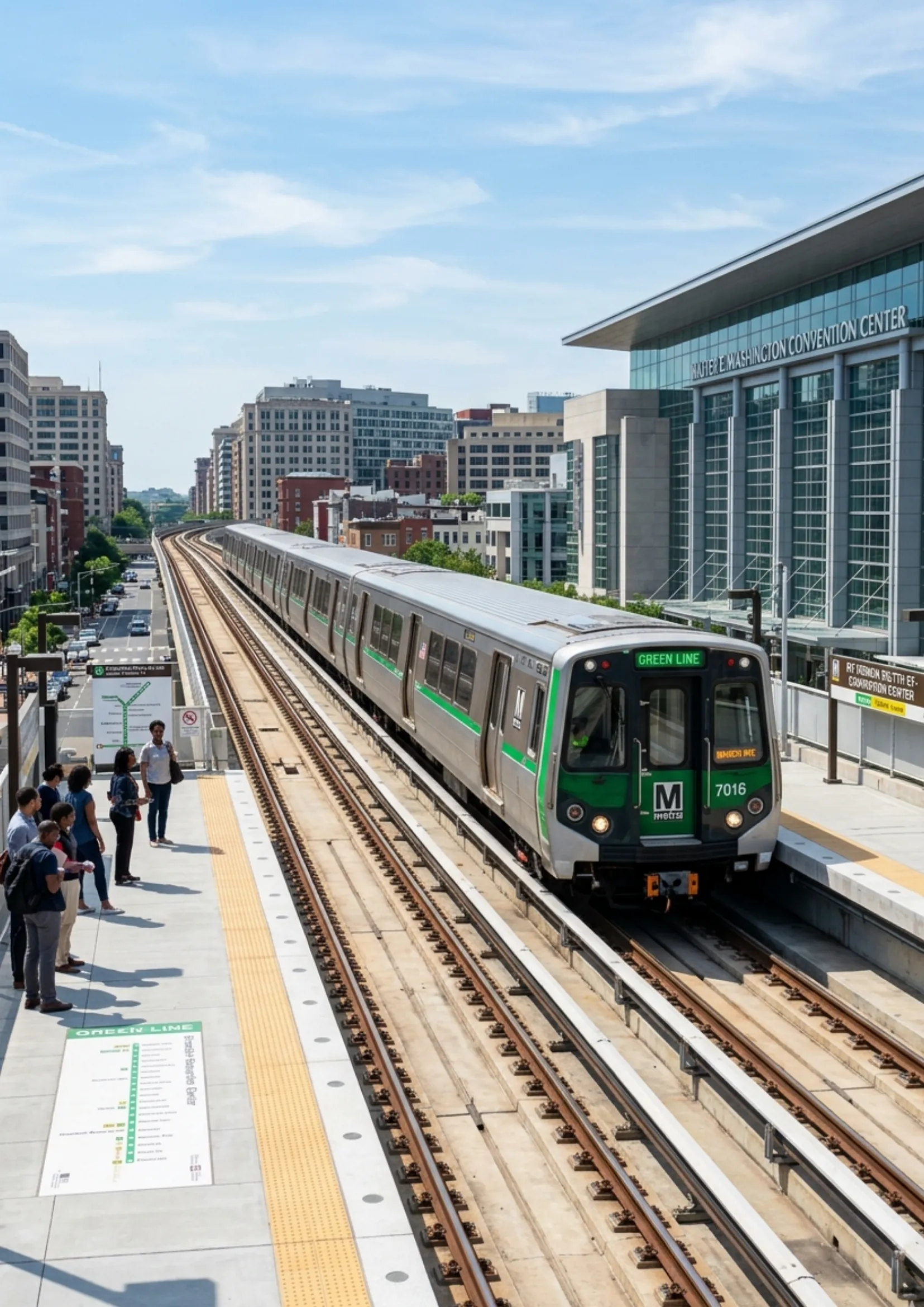
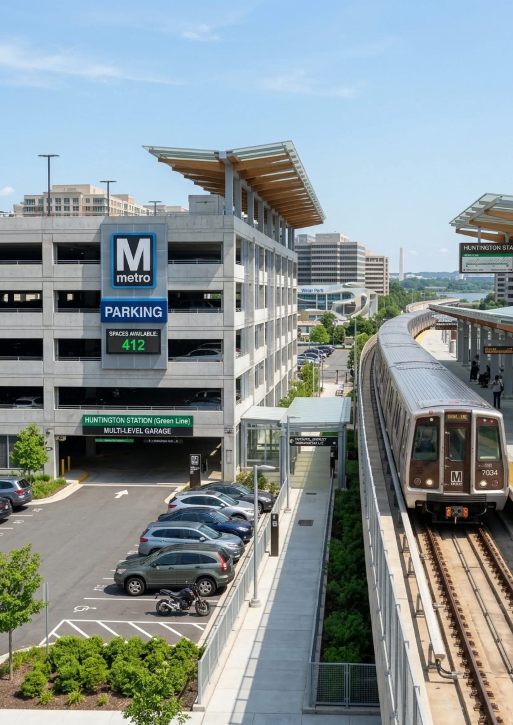
DC Metro Green Line: Neighborhoods, Nationals Park
The DC Metro Green Line runs from Branch Avenue to Greenbelt, connecting southeast and northeast D.C. It serves key areas like Navy Yard, L’Enfant Plaza, and U Street, offering vital access to residential, business, and entertainment districts.
M
Mindy Schapiro14 Apr 2026
Lines
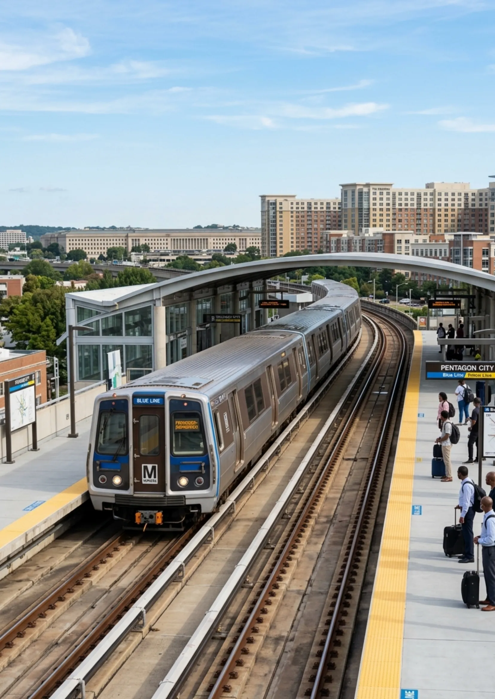
DC Metro Blue Line: Stations, Schedule & Airport Access
The DC Metro Blue Line runs from Franconia–Springfield to Largo Town Center, linking Virginia suburbs to downtown Washington, D.C. It serves key stops like Pentagon, Smithsonian, and Capitol South, providing vital commuter access.
M
Mindy Schapiro14 Apr 2026
Lines
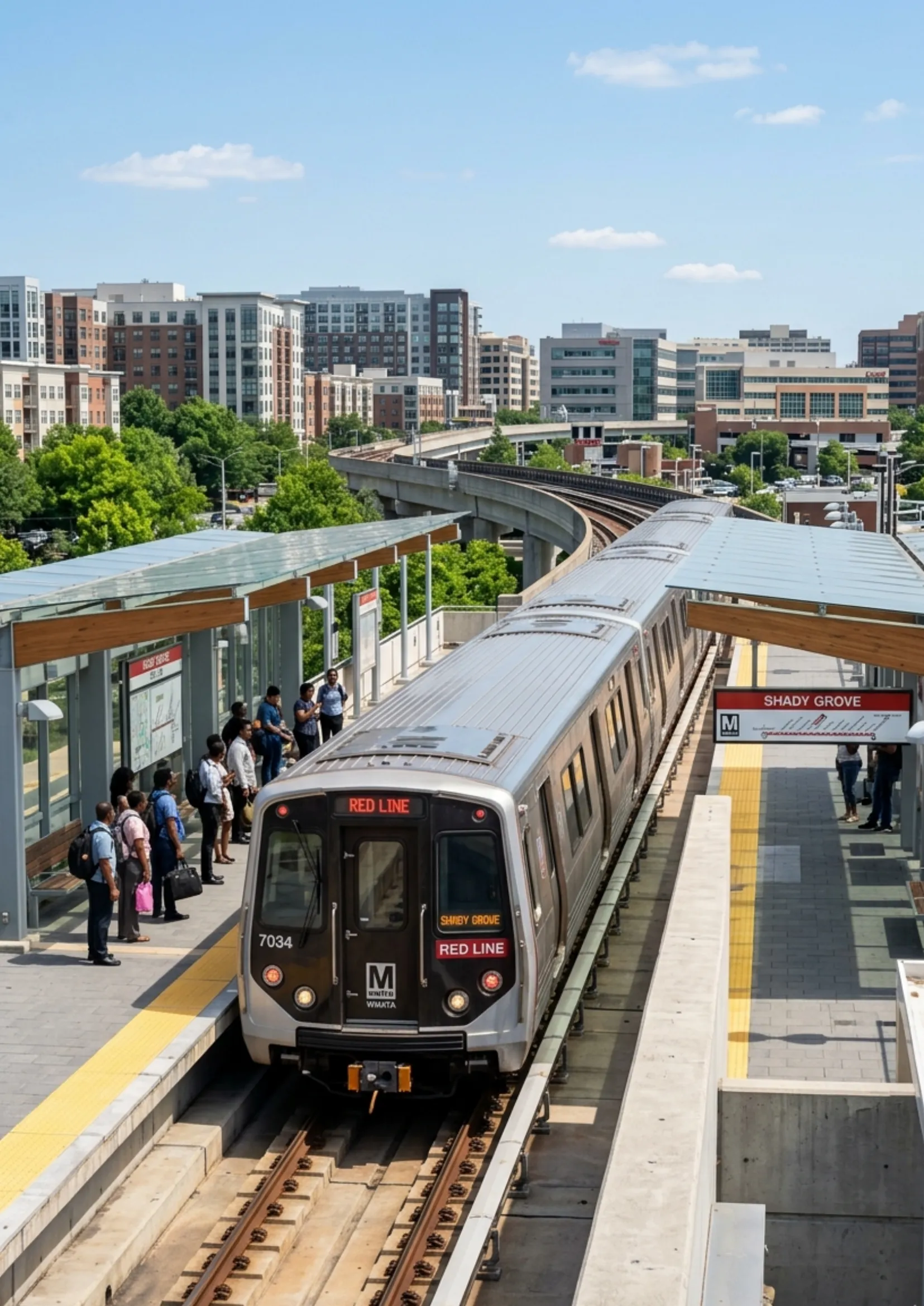
DC Metro Red Line: Every Station, Schedule
The DC Metro Red Line runs from Shady Grove to Glenmont, connecting Maryland suburbs through downtown Washington, D.C. It serves major hubs like Union Station, Metro Center, and Dupont Circle, making it one of the busiest and most vital lines.
M
Mindy Schapiro14 Apr 2026
Others
DC Metro WMATA Careers: Pay & How to Get Hired
Washington Metropolitan Area Transit Authority careers offer opportunities in transit operations, engineering, maintenance, and administration. Roles include bus operators, technicians, and transit police, with competitive salaries, benefits, training programs, and career growth through online appli
M
Mindy Schapiro14 Apr 2026
Others
DC Metro Parking: Station Rates, Daily & Monthly Fees
Washington Metro parking is available at 50+ stations with options like daily, hourly, and reserved parking. Weekday rates vary by station (typically $3–$5/day), while weekends and federal holidays are free at Metro-owned lots.
M
Mindy Schapiro14 Apr 2026
Others
DC Metro Customer Service: Contacts, Lost & Found & Help
Washington Metropolitan Area Transit Authority customer service provides support via phone, chat, and online forms for fares, schedules, and transit help. Call 202-466-3876 (7am–8pm weekdays, 8am–8pm weekends), or use live chat and feedback services.
M
Mindy Schapiro13 Apr 2026
Others
DC Metro Student and Senior Discounts: How to Apply & Save
The Washington Metropolitan Area Transit Authority offers student and senior discounts to make travel more affordable. Seniors (65+) get 50% off fares on Metrorail and Metrobus with a Senior SmarTrip card. Eligible D.C. students can ride free or at reduced cost through special programs.
M
Mindy Schapiro13 Apr 2026
Others
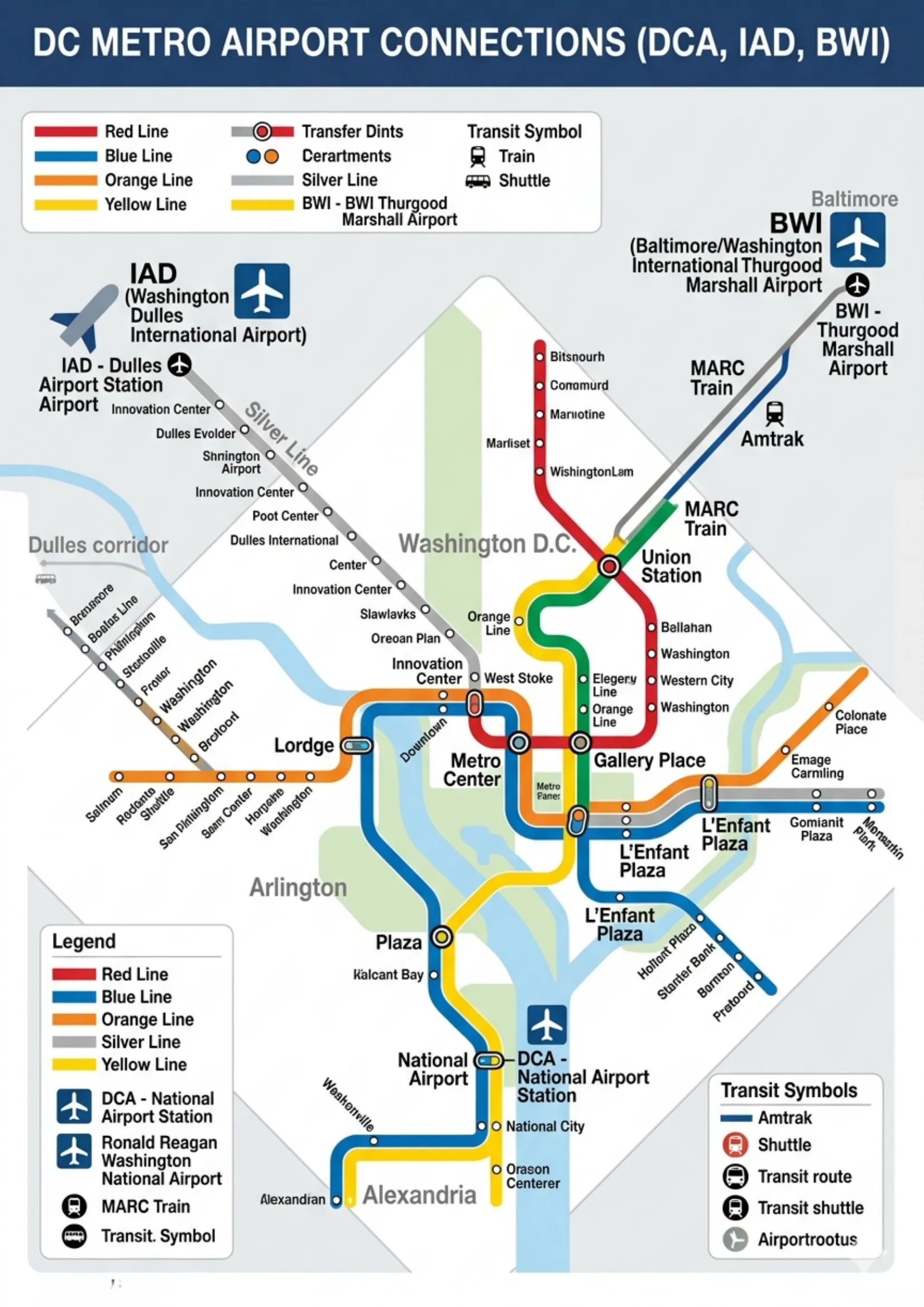
DC Metro Airport Connections: DCA, Dulles & BWI by Rail Time
Washington Metro provides direct airport connections via multiple lines. The Washington Metro Yellow Line and Washington Metro Blue Line serve Reagan National Airport, while the Washington Metro Silver Line connects directly to Dulles Airport. BWI Airport is accessible via Metro + rail transfer
M
Mindy Schapiro13 Apr 2026