Loading content...
Maps
Category
Maps
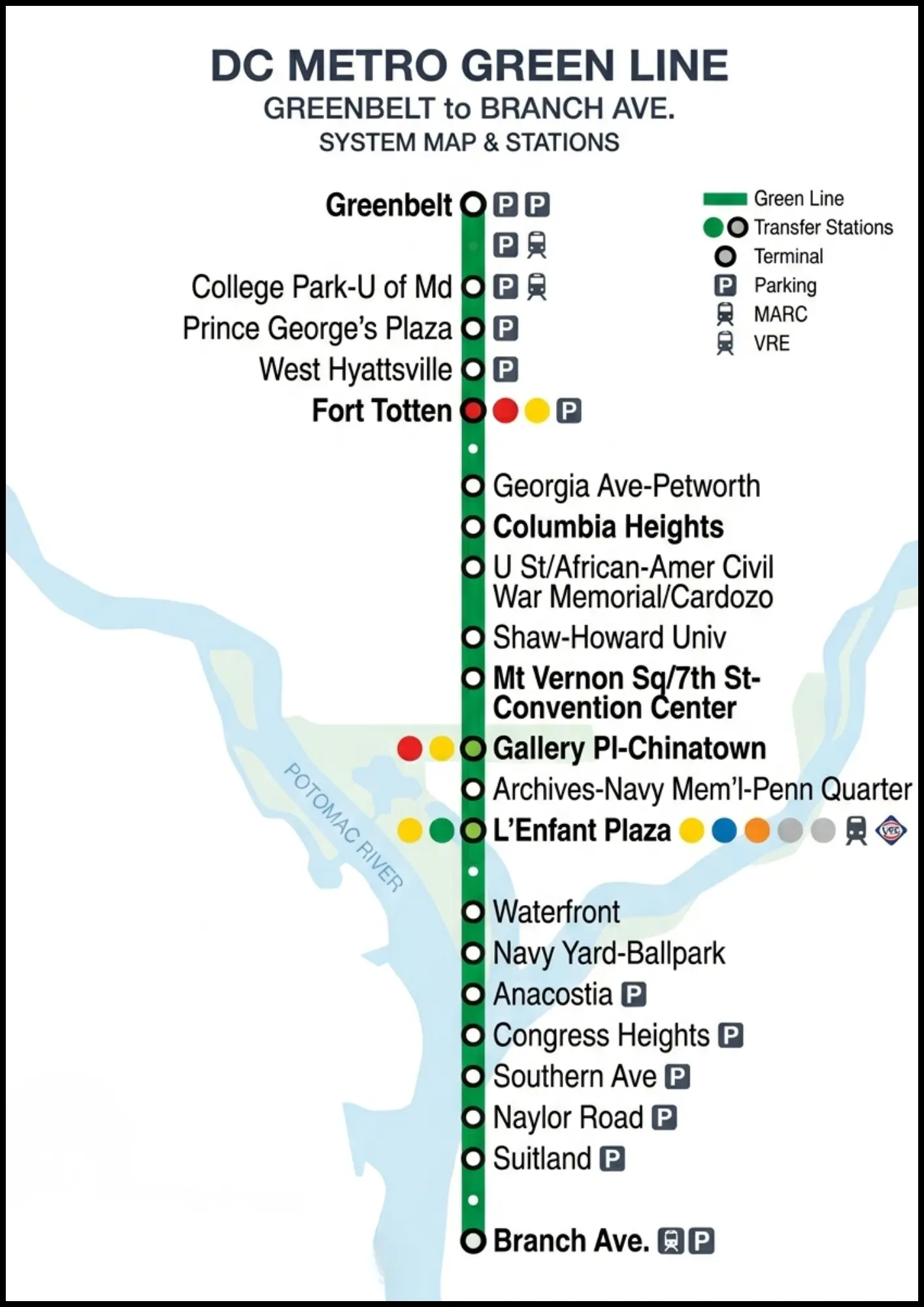
DC Metro Green Line Map: Stations, Route & Guide 2026
The Washington Metro Green Line map shows the route from Branch Avenue to Greenbelt, passing through key stations like Navy Yard, L’Enfant Plaza, and U Street. It highlights major transfer points and connectivity across Washington, D.C.
M
Mindy Schapiro13 Apr 2026
Maps
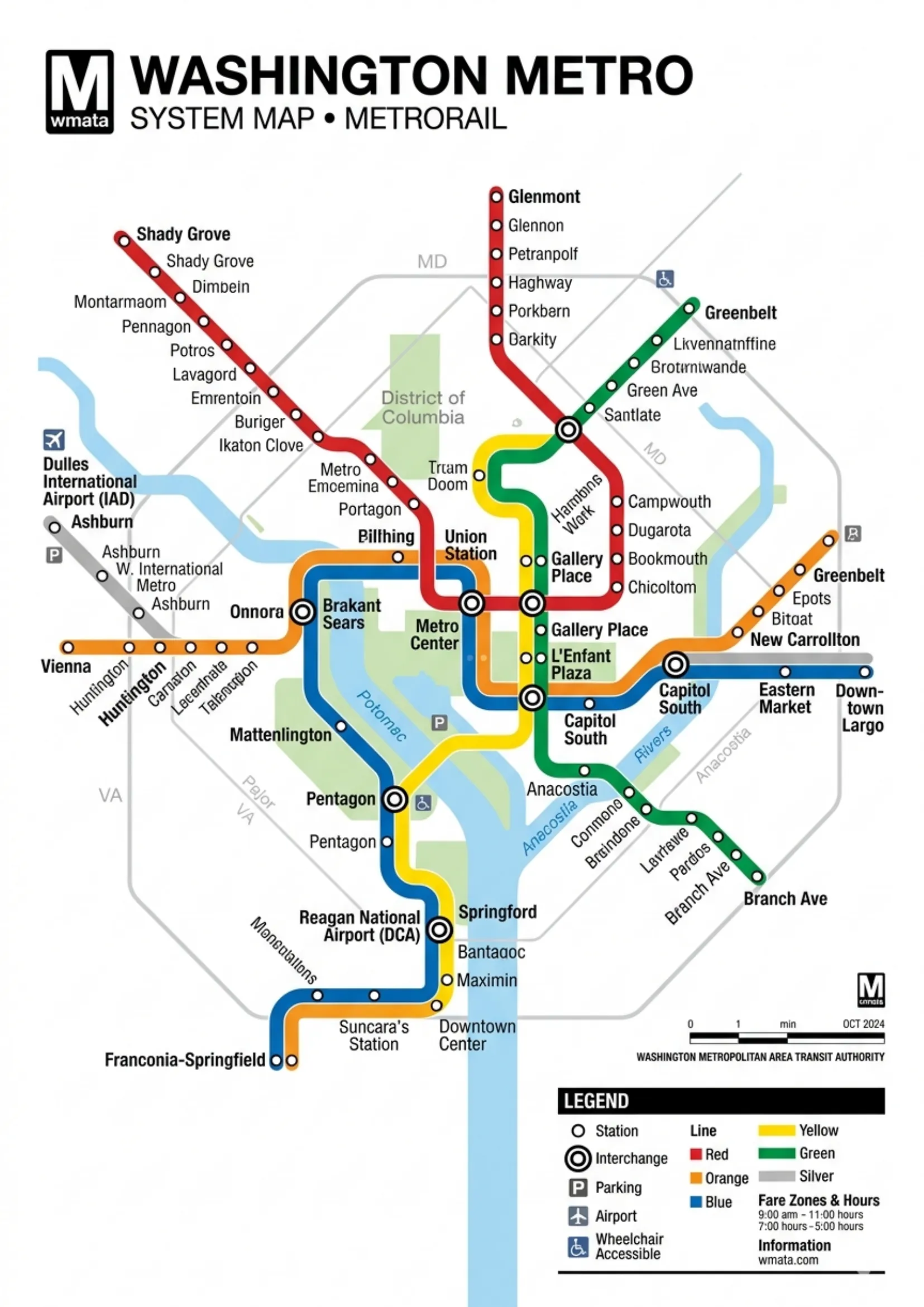
DC Metro Map 2026: Interactive Guide to All 6 Lines, Station
The Washington Metro system map shows all Metrorail lines, stations, and connections across Washington, D.C., Maryland, and Virginia. It helps riders plan routes, identify transfers, and navigate the system efficiently for daily commuting and travel.
M
Mindy Schapiro13 Apr 2026
Maps
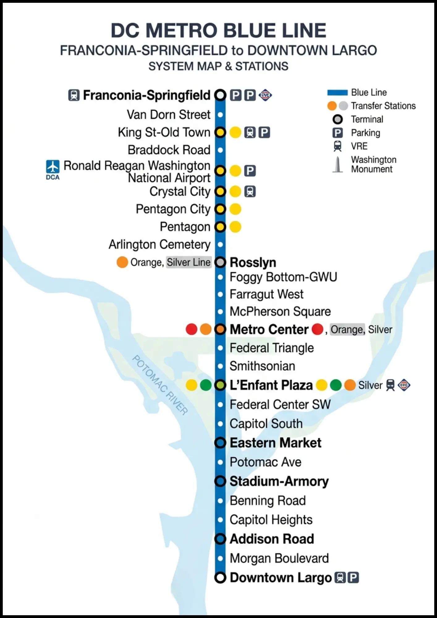
DC Metro Blue Line Map: All 28 Stations, Route, Airport
The Washington Metro Blue Line map shows the route from Franconia–Springfield to Largo Town Center, passing through key stations like Pentagon, Smithsonian, and Capitol South. It highlights major transfer points and connectivity across Washington, D.C.
M
Mindy Schapiro13 Apr 2026
Maps
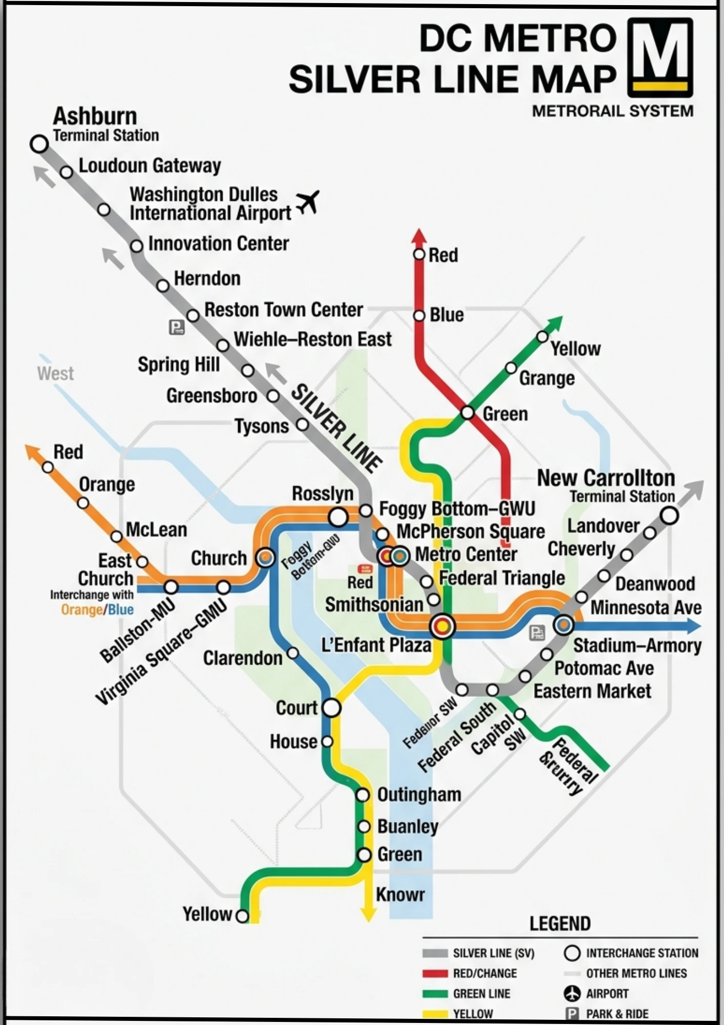
DC Metro Silver Line Map: Stations & Airport Guide 2026
The Washington Metro Silver Line map shows the route from Ashburn, Virginia, to Largo Town Center, passing through Tysons, Dulles Airport, and downtown Washington, D.C. It highlights key transfer stations and regional connectivity.
M
Mindy Schapiro13 Apr 2026
Maps
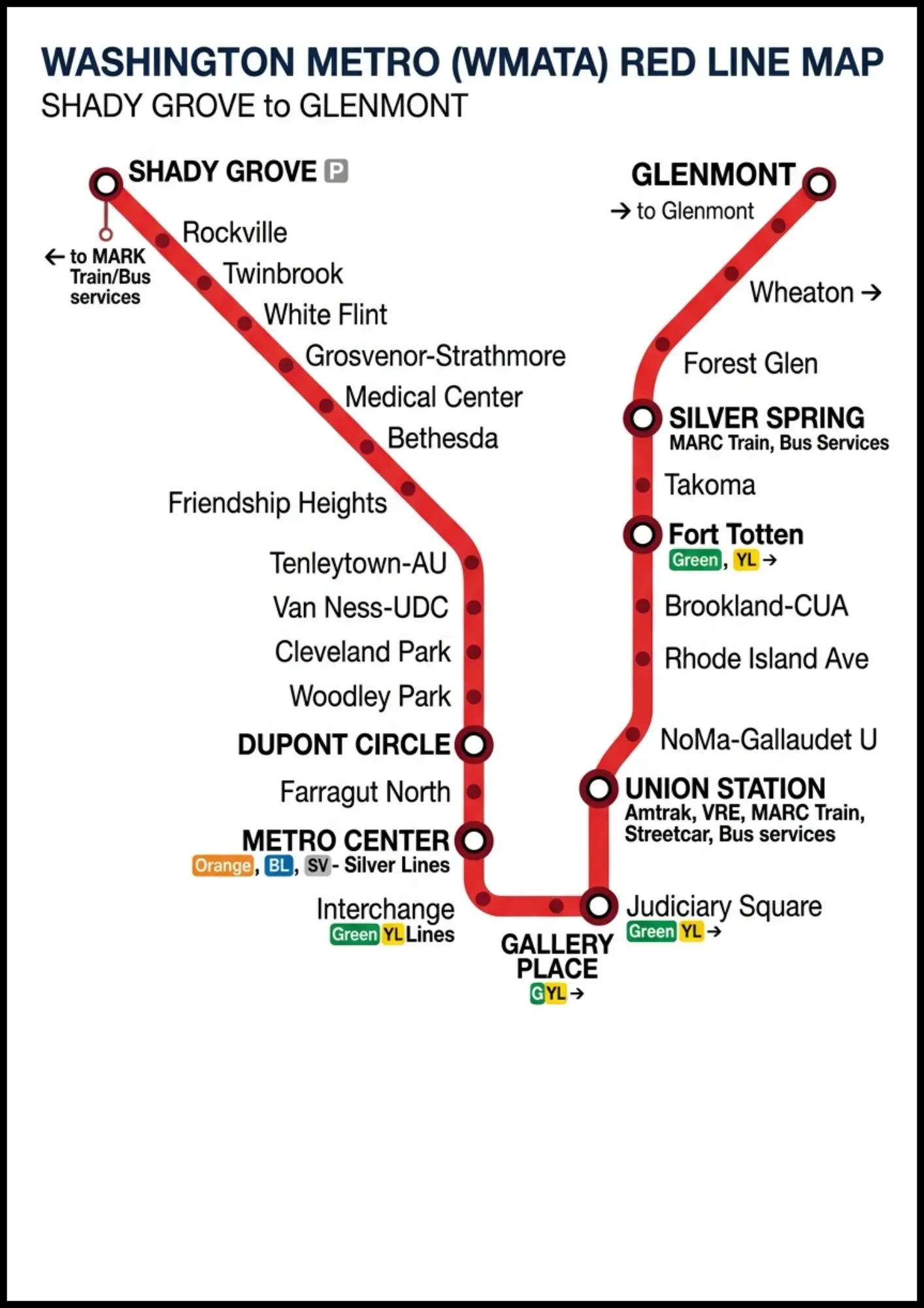
DC Metro Red Line Map: All 27 Stations, Route, Hours & Rider
The Washington Metro Red Line map shows a U-shaped route from Shady Grove to Glenmont, covering 27 stations across Washington, D.C., and Maryland. Key stops include Metro Center, Union Station, and Dupont Circle, with major transfer points along the line.
M
Mindy Schapiro13 Apr 2026
Maps
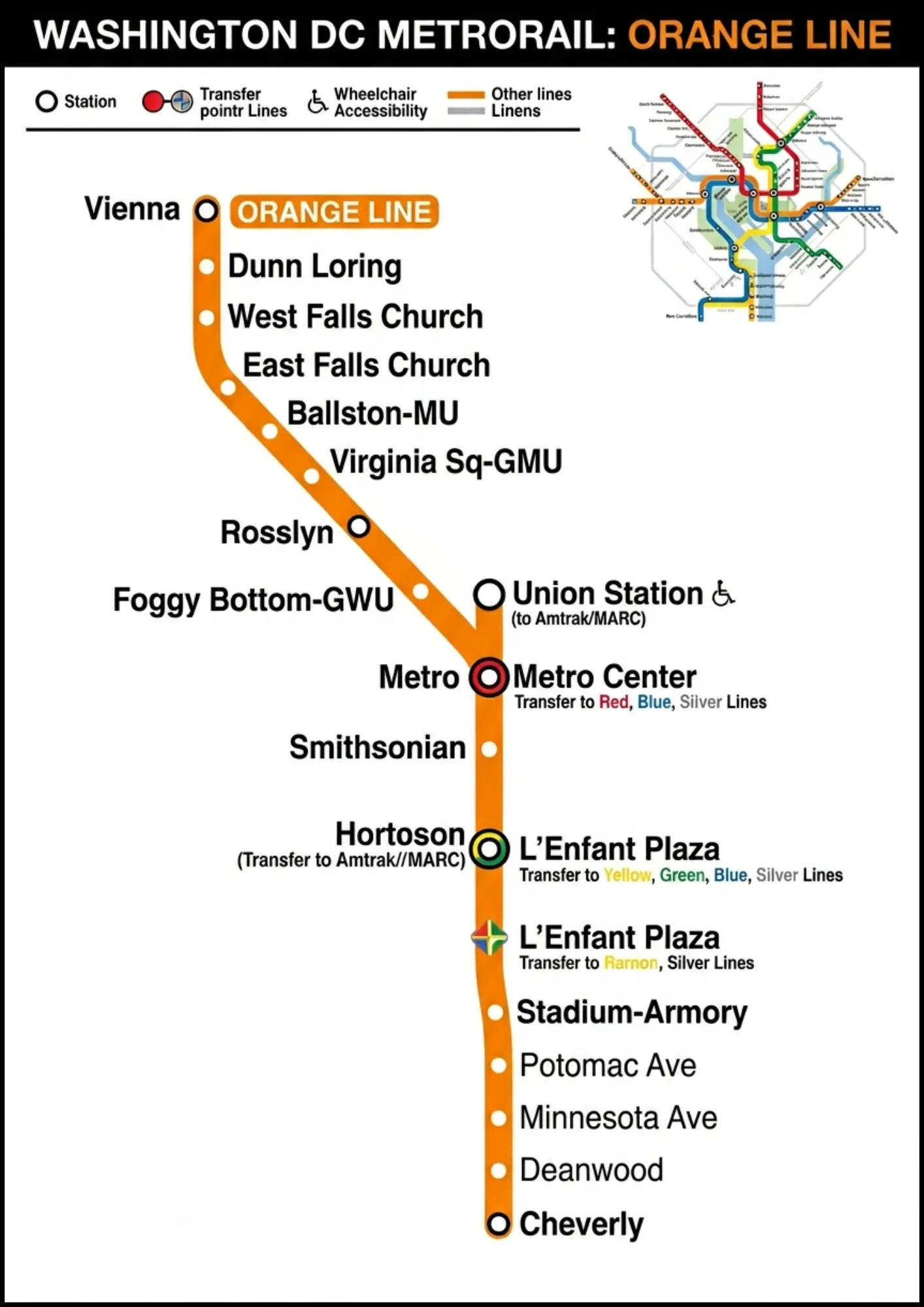
DC Metro Orange Line Map: All 26 Stations, History, Route
The Washington Metro Orange Line map shows the route from Vienna, Virginia, to New Carrollton, Maryland, passing through key stations like Rosslyn, Metro Center, and L’Enfant Plaza. It highlights major transfer points and connections across Washington, D.C.
M
Mindy Schapiro13 Apr 2026
Maps
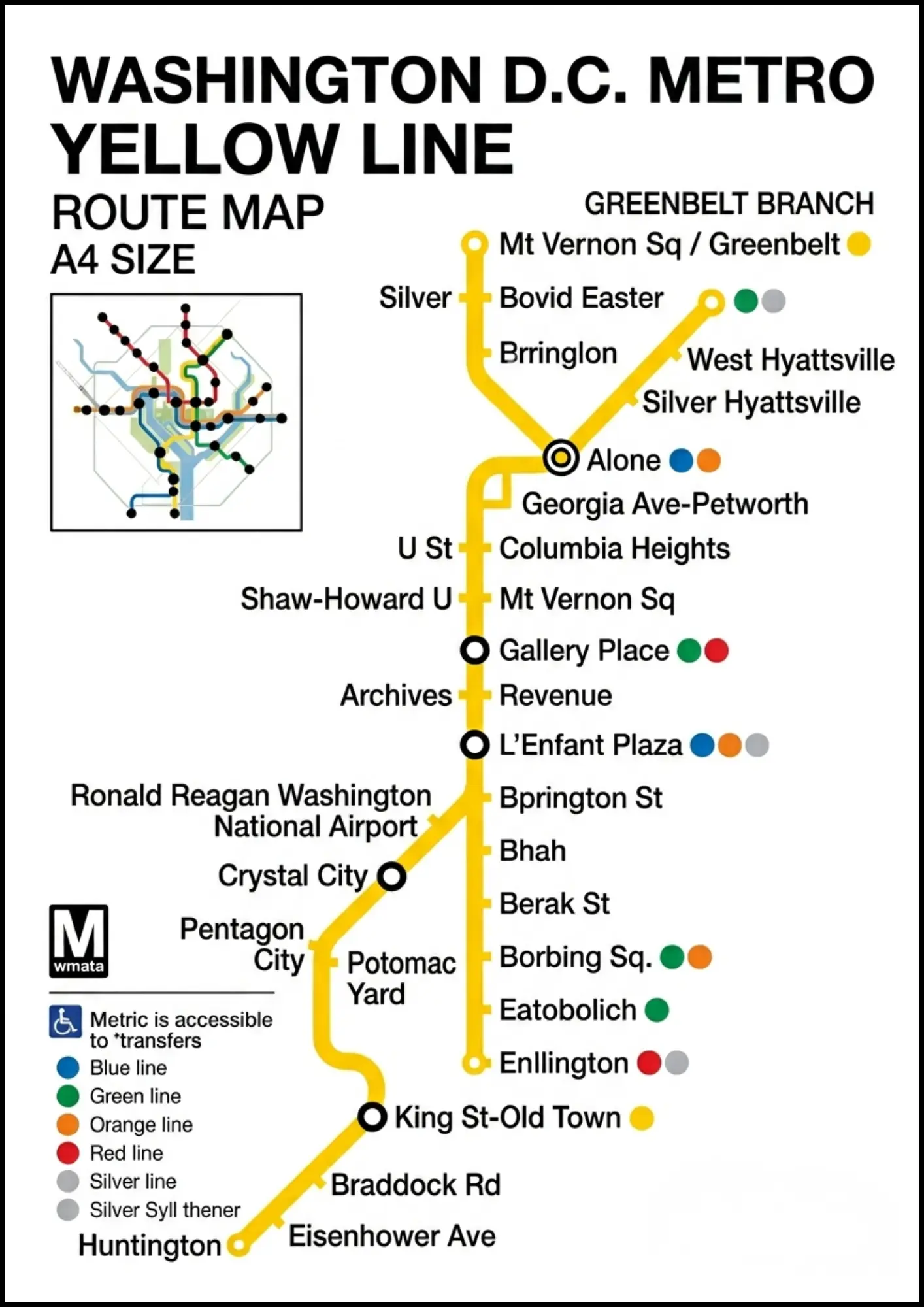
DC Metro Yellow Line Map: Stations & Rider Guide 2026
The Washington Metro Yellow Line map shows the route from Huntington, Virginia to Greenbelt, Maryland, passing through key stations like Pentagon, L’Enfant Plaza, and Gallery Place. It highlights major transfer points and connections across Washington, D.C.
M
Mindy Schapiro13 Apr 2026