Loading content...
Explore All Posts
Explore DC Metros in one place

Stations
DC Metro Waterfront Station The Wharf & Metro Guide
Planning a visit to The Wharf? This DC Metro Waterfront Station guide covers schedules, fares, accessibility, parking information, restaurants, entertainment venues, and the fastest Metro connections for exploring Southwest Washington, DC.
M
Mindy Schapiro5 Jun 2026

Stations
DC Metro Navy Yard Station Schedule & Stadium Guide
Heading to Nationals Park or the Capitol Riverfront? This DC Metro Navy Yard Station guide covers train schedules, fares, accessibility, game-day travel tips, nearby restaurants, and the fastest Metro routes for visitors and commuters.
M
Mindy Schapiro5 Jun 2026
Stations
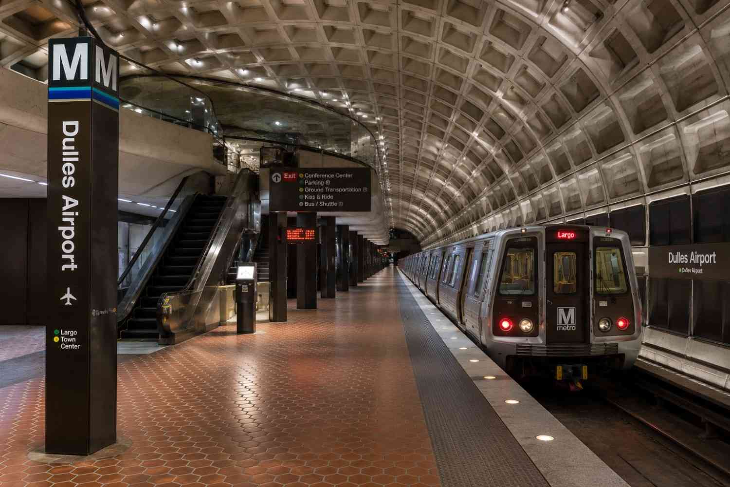
DC Metro Dulles Airport Station Schedule & Guide
Flying into Dulles International Airport? This DC Metro Dulles Airport Station guide covers Metro schedules, fares, airport access, luggage-friendly travel tips, Silver Line connections, and the fastest ways to reach downtown Washington, DC.
M
Mindy Schapiro5 Jun 2026

Stations
DC Metro Reagan Airport Station Flights, Metro & Tips
Flying into Washington, DC? This DC Metro Reagan Airport Station guide covers airport terminals, Metro access, train schedules, fares, baggage-friendly travel tips, airport connections, accessibility features, and the fastest routes to downtown DC and nearby attractions.
M
Mindy Schapiro5 Jun 2026

Stations
DC Metro Arlington Cemetery Station Visitor Guide & Tips
Planning a visit to Arlington National Cemetery? This DC Metro Arlington Cemetery Station guide covers station hours, Metro routes, accessibility features, visitor tips, nearby memorials, parking information, and everything you need for a smooth and memorable visit.
M
Mindy Schapiro5 Jun 2026

Stations
DC Metro Smithsonian Station Schedule, Fares & Travel Guide
Planning to visit the National Mall or Smithsonian museums? This DC Metro Smithsonian Station guide covers schedules, fares, accessibility, nearby attractions, Metro routes, travel times, and essential visitor information for exploring Washington, DC with ease.
M
Mindy Schapiro5 Jun 2026

Stations
DC Metro Dupont Circle Station- Schedule & Parking
Planning a visit to Dupont Circle? This DC Metro Dupont Circle Station guide covers schedules, fares, parking options, accessibility features, Metro connections, nearby attractions, restaurants, and travel tips for commuters and visitors exploring Washington, DC.
M
Mindy Schapiro5 Jun 2026
Stations
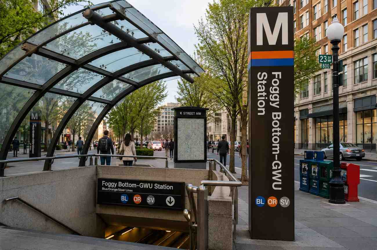
DC Metro Foggy Bottom Station Schedule, Fares & Travel Guide
Planning a visit to Georgetown, George Washington University, or the Kennedy Center? This DC Metro Foggy Bottom Station guide covers schedules, fares, parking options, accessibility features, Metro connections, nearby attractions, and travel tips to help you navigate Washington, DC with ease.
M
Mindy Schapiro5 Jun 2026
Stations
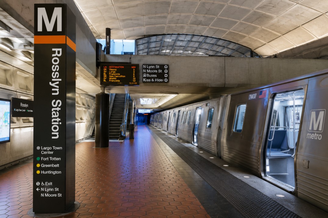
DC Metro Rosslyn Station- Schedule, Fares, Parking & Travel
Get complete information about DC Metro Rosslyn Station, including schedules, fares, parking options, Metro lines, accessibility features, nearby attractions, and travel times for commuters and visitors.
M
Mindy Schapiro5 Jun 2026
Stations
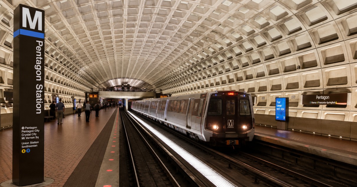
DC Metro Pentagon Station-Schedule, Fares & Parking (2026)
Get complete information about DC Metro Pentagon Station, including schedules, fares, parking options, Metro lines, accessibility features, nearby attractions, travel times, and essential tips for commuters, tourists, and first-time visitors.
M
Mindy Schapiro5 Jun 2026